PHOTO
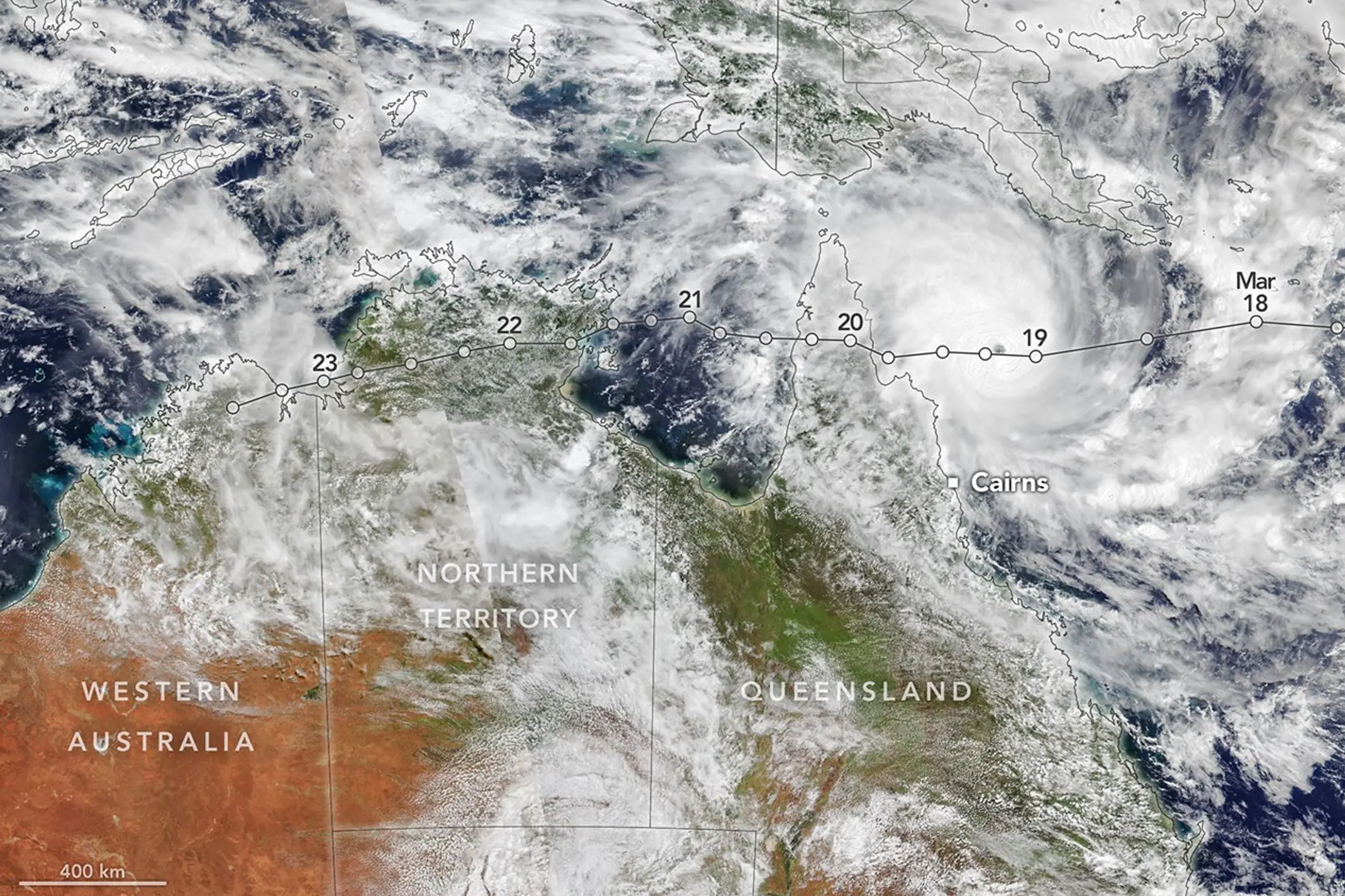
The main weather feature of the past 10 days was tropical cyclone Narelle which first formed in the Coral Sea east of Cooktown and then crossed the coast and passed into the gulf near Weipa which had 688mms of rain in three days - the heaviest March rainfall since 1996.
Narelle then moved west into the Carpentaria region of the NT with the heaviest rain being at Katherine where 475mms fell in two days, causing major flooding.
Katherine had heavy rain in both January and February and has seen its wettest January to March period since 1899 - when above average rainfall fell over most of Victoria in June that year.
Cyclone Narelle moved into the Kimberley region of WA and then deepened to a central pressure of 946mmbs near Onslow where the strongest winds of just under 200kph ocurred.
Narelle came very close to Perth where 63mms fell to last Saturday morning, March 28 - the heaviest fall since 77mms in 1934.
Other cyclones which affected Perth in March were in 1923 and Cyclone Mavis in late March 1971.
All three resulted in notably warmer days and very dry conditions for the next three weeks in SA and Victoria and most of NSW.
An active cold front passed over Victoria last Tuesday night, 24 March, with variable rainfalls and thunderstorms with strong gusty southerly winds and temperatures well below the March normal.
This cold airmass then moved very quickly right up to the Maranoa and Warrego region of Queensland.