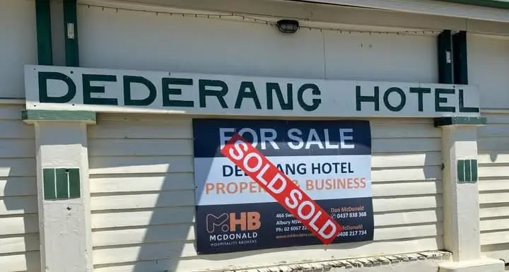
PHOTO
By JOHN TAYLOR OAM, Myrtleford and District Historical Society Inc.
BEFORE Myrtle Creek Village was surveyed and named 'Myrtleford' in 1858, words had become associated with localities and thoroughfares.
The miner's trek through the Myrtle Creek Pastoral Run had been named the 'Buckland Road' and places of significance for the First Peoples of the area were adopted for various localities.
Locally, we use names used by original inhabitants for a camping place at Nug Nug Wah, Eurobin (lagoon at foot of a mountain), Whorouly (black cockatoo or underwater), Mudgegonga (deep reverberating sound), Barwidgee (white water). The North East has many.
The old Buckland Road became Myrtle Street, named after what settlers believed were myrtle trees at the ford across the creek coming into town.
A cluster of streets then developed after the first land sales in 1861.
Some early names were associated with royalty.
Apart from King, Queen, Duke and Prince Streets, there was 'Victoria Bridge' over the Happy Valley Creek (named after Queen Victoria), Albert Street (named after Prince Albert, consort to the Queen), Alice Street (named after their third child and second daughter) and Maude Street (named after Maude of Wales, youngest daughter of King Edward VII and Queen Alexandra, who became Queen of Norway).
Elgin Street refers to an ancient cathedral city in Scotland (or possibly to Lord Elgin and those Parthenon Marbles) and runs parallel to Clyde Street, named as a tribute to Scotland's third longest river.
Standish Street salutes the efforts of Capt. Standish, Chief Commissioner of Police, in suppressing bushrangers in north–east Victoria.
Names of several prominent developers and businesspeople were selected for streets as more development of the residential network occurred, particularly in the northern area of town.
These names included O'Donnell Avenue, after the original settlers at Merriang in 1864, who later became associated with an early stock and station agency.
A poignant note was added to the name in May 1943, with news of the drowning of Sister Alice Margaret O'Donnell on the Hospital Ship 'Centaur', when it was torpedoed off the Queensland coast.
Robertson Street was named after storekeeper Jessie Robertson and family, who commenced over a century of trading from the foot of Reform Hill from 1869.
Later, eldest son J.B. Robertson would move the store to Clyde Street with his brothers and be acknowledged in John Street and Bird Avenue.
The role of pioneering farming family members and their community–minded efforts as Bright Shire Council representatives is acknowledged in naming three other thoroughfares: Cr. John Smith, 1919–39 (in the centre of town), Cr. John R. Mummery, 1932–39 and Cr. John Woodside, 1892–97 (both on the town's northern boundary).
Other prominent families would lend names to streets and laneways in the post–war era: Williams, Rayner, Macaulay, Ashdown, Swinburne, Lowerson, Briggs, Chambers, Clemens, Howell, Hall, Heather, Power, Gerraty, McFadyen, Moore, Pinniger, Watson, Lewis, Ewart, Leggio, Martin, Whalley, Toner, McGeehan, Clancy and Disher. They include farmers, carriers, retailers, builders, four more shire councillors, a politician, an electrician and two publicans, all committed to some form of community involvement.
Aboriginal meanings would also be applied in naming a new area at the "Big Tree", Yarrah Place, and in Banool Avenue ("hill"), Undara Road ("long way") and Carcoola Avenue ("eucalypt"). The gold mining era would be acknowledged in Lucknow and Tarrengower Courts.
Two other street precincts, quietly memorialize the passing of young citizens: Wireless Operator Sgt. Geoffrey Douglas Mummery RAAF, aged 21, shot down over Hamburg, Germany on March 7, 1945, and winter Olympian Leslie Ross Milne, who died aged 19 in a skiing accident at Innsbruck, Austria in January, 1964.
Geoffrey Street, Ross Court and Milne Avenue acknowledge their passing.
Reserves and parklands also pay tribute to community service, acknowledging roles played by Rotary, Jaycees, Apex and Lions clubs, the Italian community and individuals such as Ron McNamara, Cr. J.A. Jones, Clarrie Ardern, Hon. Ivan Swinburne MLC and William Cundy and family.
In the Mudgegonga district, names of selectors and significant places appear on maps: Hardy Lane, Carroll's Road, De Piazza Lane, Brown Road and O'Callaghan Lane, Black's Flat and Tunnel Gap Roads.
Out at Gapsted, the McIlroy and Rae families and the alluvial–rich Stoney Creek lend their names to roadways and at Buffalo River pioneers are acknowledged at McLees' Lane, Marshall's Ridge and the Osborne and McGuffie Bridges.
Other named river crossings were lost to floods or inundation last century.
On the road to Happy Valley, Seltzer's Lane recalls the family and work of the Cr. J.R. Selzer, first president of the Shire of Myrtleford.
Further out, McCormack's Lane acknowledges early land selection after 1869 and at Browne's Lane the efforts of a World War 1 soldier settler.
These are just a sample of our street and locality names.
They all tell us something about where we live and the origins of Myrtleford's story.